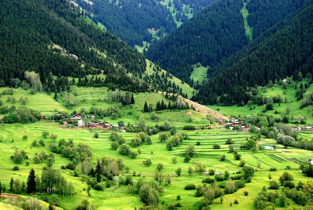
Şavşat is a mountain district in Artvin Province, northeastern Türkiye, where forested valleys, high plateaus, historic villages, and medieval ruins shape a remote Black Sea journey. It suits travelers who value scenery and slow exploration more than a packed attraction list.
Distances are deceptive: the district center is small, but Karagöl, Sahara Plateau, Cevizli, and other villages are spread across winding roads. A rewarding visit needs flexible transport, changing-weather gear, and at least two full days.
This Şavşat travel guide explains the main sights, seasonal choices, local food, access, and a practical itinerary. Travelers who need maps and translation can compare iRoamly travel eSIM plans before entering the mountain region.
Why Visit Şavşat?
Şavşat offers a quieter alternative to the busier Black Sea coast. Lakes, spruce and pine forests, pastureland, wooden houses, and village food are central to the experience.
The town belongs to the Cittaslow Türkiye network, which emphasizes local identity, environmental care, and a measured pace of life. That label is a useful clue for how to travel here: stay longer, buy locally, and avoid treating villages as scenery alone.
Planning point | What it means in Şavşat |
|---|---|
Best for | Forest scenery, village culture, photography, gentle walks, and regional history |
Suggested stay | Two to three nights for several areas without constant driving |
Main challenge | Long road transfers, variable weather, and limited rural services |
Transport style | Private car, hired driver, or locally arranged excursions |
Şavşat within the wider Artvin region
Şavşat is one part of a large, mountainous province. The Artvin travel guide helps compare it with the provincial center, Borçka, and other Black Sea landscapes before choosing a route.
Do not expect every attraction to sit near town. Build each day around one direction or cluster, and ask accommodation hosts about road condition and travel time.
History and Cultural Landmarks
Şavşat stands in a borderland shaped by medieval Georgian polities, Ottoman rule, village migration, and trade across mountain passes. The district’s official tourism overview lists castles, churches, historic mosques, lakes, and traditional crafts.
Many ruins are unstaffed and exposed to weather. Treat them as fragile heritage sites, do not climb unstable masonry, and confirm current access before making a long detour.
Şavşat (Satlel) Castle
The castle rises on rock near Söğütlü, just outside the district center. Surviving walls, cistern remains, and a chapel trace its defensive and religious uses.
The exact construction date is uncertain, though its plan resembles Bagratid-period fortifications. A broader Turkish history overview can place later Ottoman and republican periods in context without reducing the castle to one era.
Tibeti Church in Cevizli
Tibeti, also written Tbeti, is a ruined medieval church in Cevizli village. It is not a “Tibetan church”; the similar English spelling is misleading.
Only parts of the structure survive, and archaeological or conservation activity can change access. View stonework carefully from permitted areas and avoid touching carvings.
Karagöl-Sahara National Park and Nature
Karagöl-Sahara National Park has two separate sections: the forest lake at Karagöl and the open highland landscape around Sahara Plateau. They should not be treated as one compact stop.
Road distance, fog, rain, or snow can turn a short map line into a slow drive. Choose one major nature area per half-day and leave daylight for the return.
Karagöl
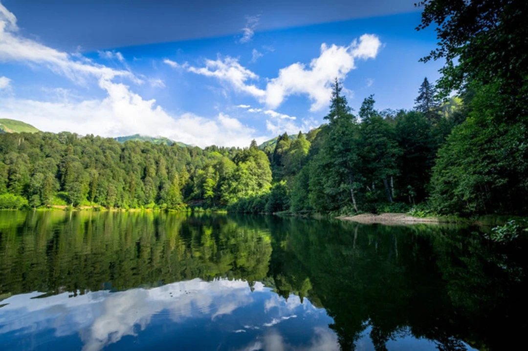
The forest-framed lake is one of Şavşat’s signature landscapes. Visitors come for reflections, picnics, short walks, and autumn color rather than demanding mountain trekking.
Use designated paths and picnic areas, carry waste out, and keep food away from wildlife. Swimming, camping, fires, and facility access may be regulated, so follow current signs and ranger instructions.
Sahara Plateau
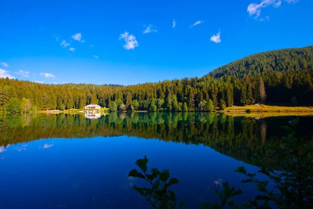
Sahara is a highland area of pasture and broad views rather than a lakeside extension of Karagöl. Conditions are cooler and more exposed, even when the district center feels mild.
Festival dates, road access, and seasonal facilities vary. Confirm them locally and bring a warm, waterproof layer rather than relying on a summer forecast from a lower elevation.
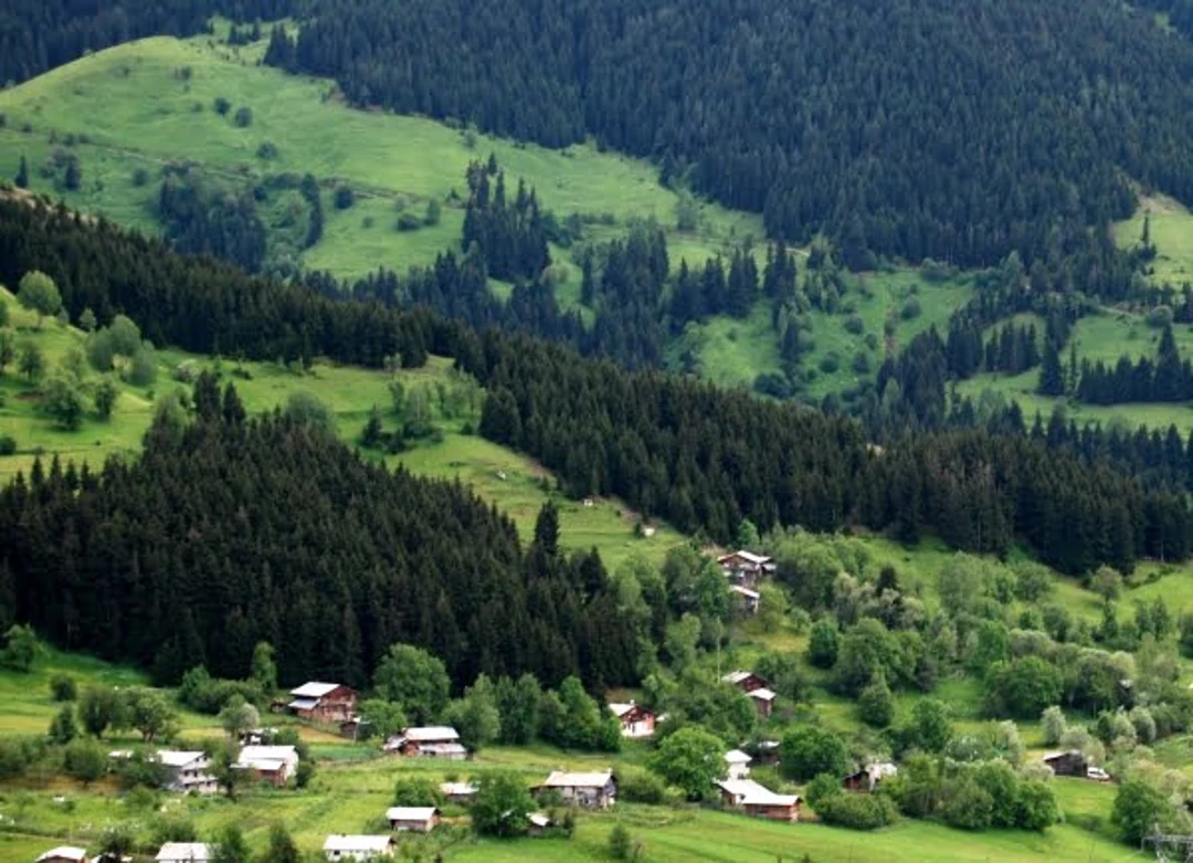
Papart Valley and village roads
Papart and other rural valleys appeal to experienced hikers and travelers with local knowledge, but marked routes and mobile reception should not be assumed.
For any remote walk, share the route, carry offline maps, check weather, and turn back before visibility or daylight deteriorates. A local guide is the safer choice for unfamiliar or unmarked terrain.
What to Eat in Şavşat
Local cooking reflects Artvin’s highland and Black Sea setting, with cornmeal, dairy products, pastries, greens, beans, honey, and preserved foods. The wider Turkish food guide explains national dishes, while Şavşat rewards asking what was made locally that day.
Food | What to expect | Ordering tip |
|---|---|---|
Mısır ekmeği | Dense corn bread served with soups, greens, or dairy dishes | Ask whether it is baked fresh that day |
Kuymak or muhlama | Hot cornmeal and cheese dish with regional variations | Share it; the portion can be rich |
Kete | Layered or filled pastry made in several eastern regional styles | Ask whether the filling is savory or sweet |
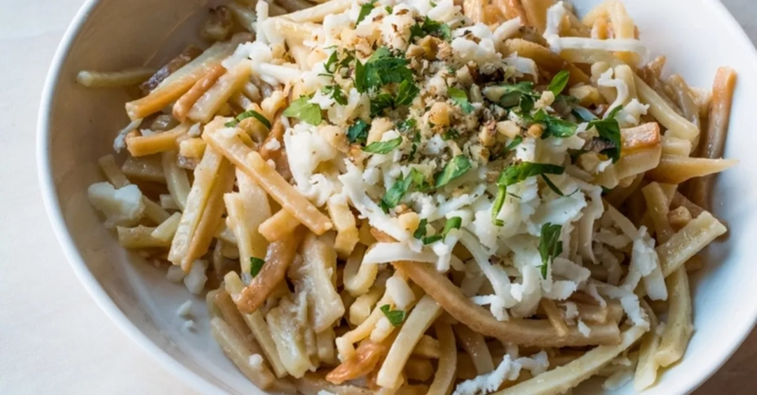
Pekmezli erişte | Noodles served with molasses in a sweet-savory combination | Availability may depend on the household or restaurant |
Village cheese and honey | Products whose flavor changes by producer and season | Check the origin, storage, and sealed packaging before travel |
How to Plan a Şavşat Trip
Şavşat is reached by road. Travelers generally connect through Artvin, Ardahan, Kars, or a regional airport, but the best gateway depends on season, onward plans, and available transfers.
Do not choose an airport by straight-line distance alone. Compare the complete road transfer, mountain-pass conditions, daylight, and whether a rental company permits the intended route.
Trip stage | Practical approach |
|---|---|
Before arrival | Confirm the final road transfer and accommodation check-in time |
Exploring villages | Use a private car, driver, or locally arranged tour; rural public transport can be limited |
Daily routing | Group places by direction and avoid crossing the district repeatedly |
Winter travel | Check closures, snow equipment requirements, and driver experience |
Best time to visit
Late spring through early autumn is the easiest period for general sightseeing, but high roads may retain snow later than the valleys. Autumn color is beautiful but brief and weather-dependent.
Winter travel can be rewarding for snow scenery, yet it requires suitable tires, flexible bookings, and comfort with mountain conditions. Never treat a clear forecast as proof that every village road is open.
A practical three-day outline
Unlike many top attractions in Rome, Italy, which are concentrated within walkable historic districts, Şavşat’s sights are spread across valleys, mountain roads, and rural areas, making driving time an important part of daily planning.
If you only have a few days, choosing a route structure that suits the destination is often more important than simply adding more stops. A three-day itinerary in Şavşat is typically based in one area, with each day devoted to a different road corridor.
Day | Focus |
|---|---|
1 | Arrive, explore the district center and Satlel Castle, then confirm road plans |
2 | Karagöl and nearby villages at an unhurried pace |
3 | Sahara Plateau or Cevizli and Tibeti Church, chosen by weather and road condition |
Money, supplies, and connectivity
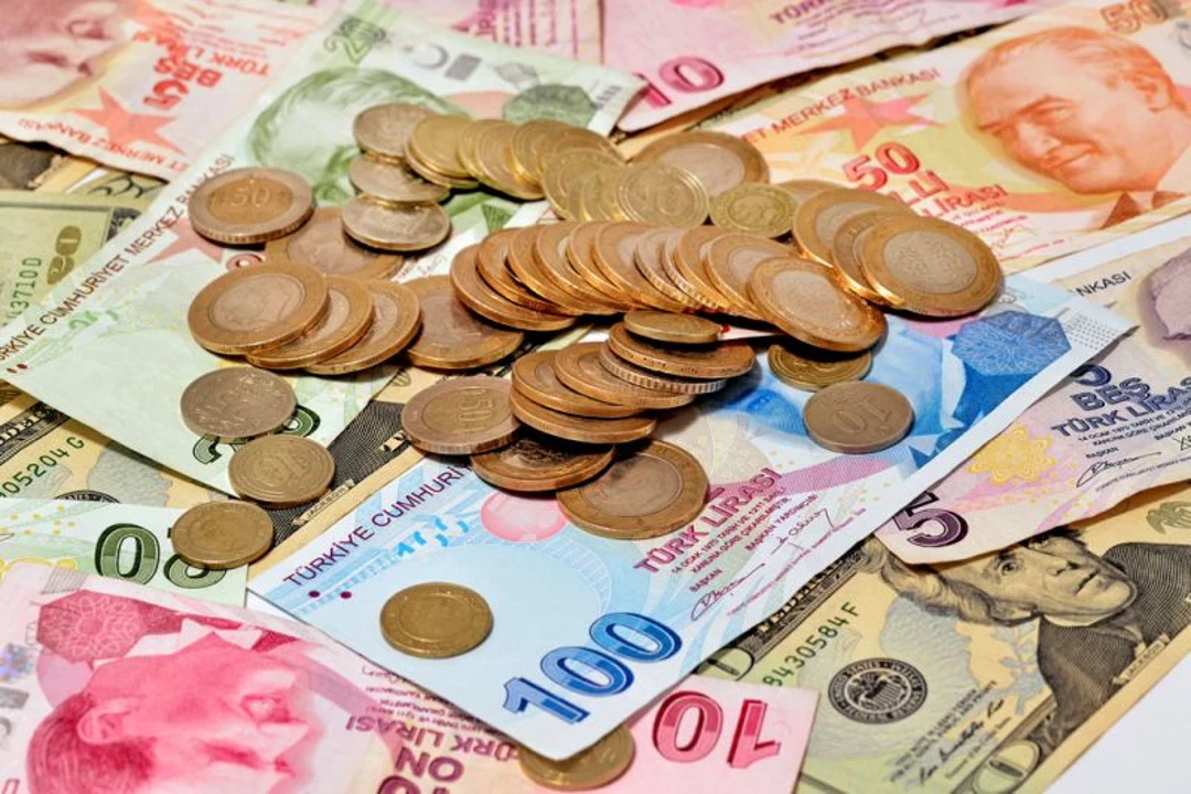
Carry Turkish lira for village cafés, small shops, and locally arranged transport. Fuel early, carry water and snacks, and do not assume every settlement has an ATM or card terminal.
Download offline maps and save your accommodation location. A Turkey eSIM can support navigation and translation, but remote valleys may still have weak or no signal.
FAQ
1. How many days do I need in Şavşat?
Plan two to three nights so road travel, weather, Karagöl, villages, and historic sites do not become rushed.
2. Can I visit Şavşat without a car?
You can reach the district by road transport, but a driver, tour, or locally arranged vehicle makes scattered rural sights much easier.
3. Is Karagöl beside Sahara Plateau?
No. They are separate sections of the national park and require different road approaches.
4. Is Tibeti Church connected to Tibet?
No. Tibeti or Tbeti is the historic site name; the church is a medieval monument in Cevizli village.
5. Do I need cash in Şavşat?
Carry some lira for small businesses and rural services because card terminals and cash access are less predictable outside the district center.
6. Does mobile data work everywhere?
No. Coverage can weaken in forests and remote valleys, so save offline maps and share plans before leaving town.
Conclusion
Şavşat rewards travelers who plan for distance rather than counting attractions. Karagöl, Sahara Plateau, villages, food, and medieval heritage each deserve time.
A two- or three-night stay, one geographic cluster per day, and locally confirmed road information create a safer and calmer trip. Seasonal flexibility is essential in this mountain district.
Travel lightly on the landscape: stay on permitted paths, carry waste out, respect private village life, and support local accommodation and food producers.