
When you glance at a map of China the size and diversity of the country just astounds you.
Extending from the frigid plateaus of the north to the balmy beaches of the south, and from the teeming metropolises of the eastern seaboard to the arid deserts and high mountains of the west, China is a land of natural and cultural diversity.
This guide is here to help you wrap your head around China geographically — and to motivate your trip to explore its provinces.
To make your journey even smoother, don’t forget to bring an iRoamly China travel eSIM to stay connected wherever you go.
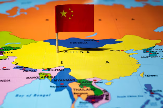
China on the World Map
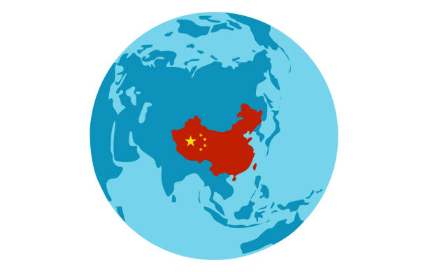
Think of a giant expanse of land in the middle of East Asia — that’s China. Landlocked at the heart of the region, 14 different countries border it, like Russia, India, and Vietnam.
Just think about what an enormous country it is! It ranks third or fourth in the world in overall size, depending on how you slice it. And it’s not just big — it’s incredibly diverse. There are deserts, tropical rainforests, high mountains, and bustling coasts.
Every borderland is a historical and cultural story in the blend of nationalities that is modern-day China.
See more of the amazing landscape of China. The country is impressive, from the dry, sandy plains of the Gobi Desert to the lush jungles of Yunnan.
At the northern end of the country, the wide highlands look like they could touch the clouds above the mountains in the distance while the bustling life-filled coast spreads out below, leading ships and explorers to new and far-off lands.
It’s a wonderful land where the diversity of nature sets the backdrop for nonstop discovery.
Geographic Regions of China
China is a truly breathtaking place. Think of it as a patchwork quilt, made up of five incredibly diverse regions, each with its unique character.
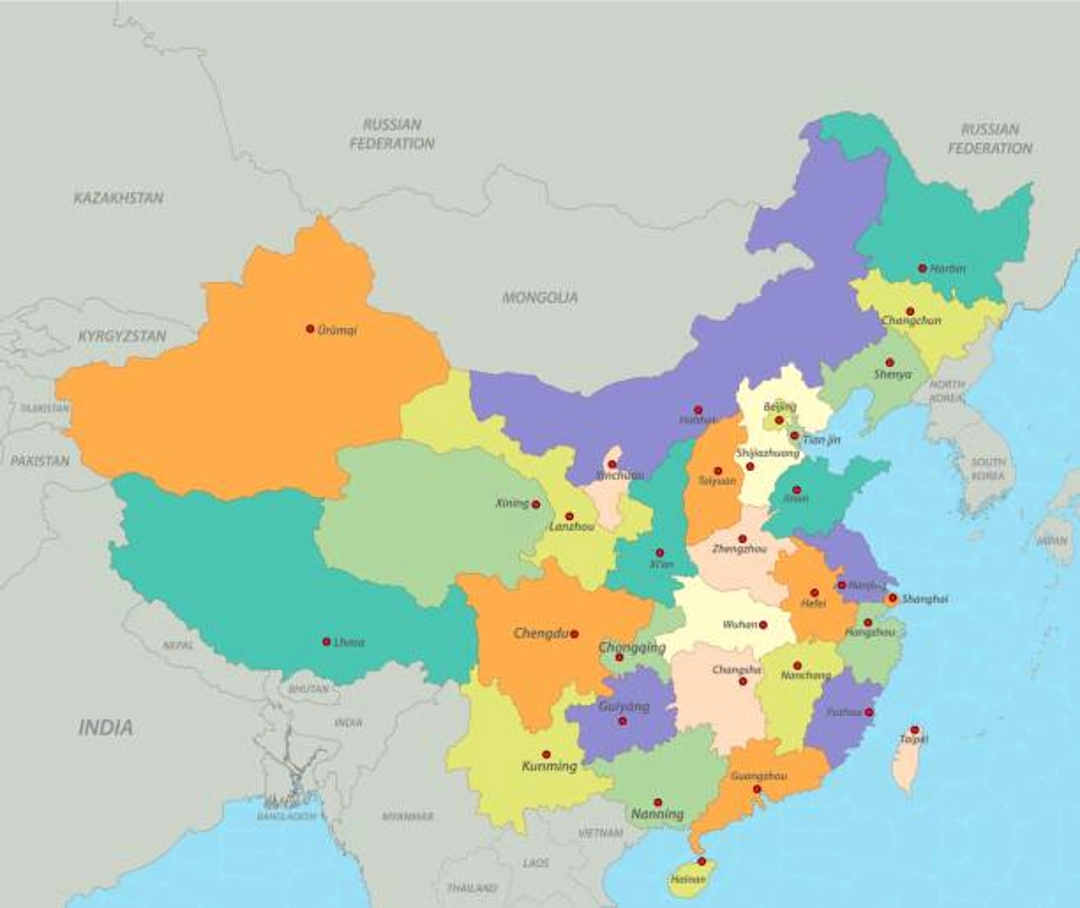
The first is Northern China. This is where you’ll find cities like Beijing and Tianjin, as well as the historic Great Wall. There’s also Inner Mongolia. The wide-open landscapes exude an untamed sense of freedom.
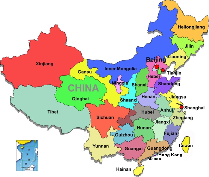
Now, imagine yourself in the South of China. The region is made up of stunning landscapes and cultural wonders.
There are places like Guilin where karst mountains dot the landscape and in Guangzhou you’ll see a city that’s equal parts modern and subtropical.
The area is bursting with different ethnicities, making for a unique experience.
Finally, head east to experience a unique blend of old and new. Eastern China is home to bustling cities like Shanghai, one of the most modern cities in the country.
Yet, incredibly ancient microcities still thrive in places like Hangzhou and Suzhou, where timeless charm and literary elegance shape the atmosphere.
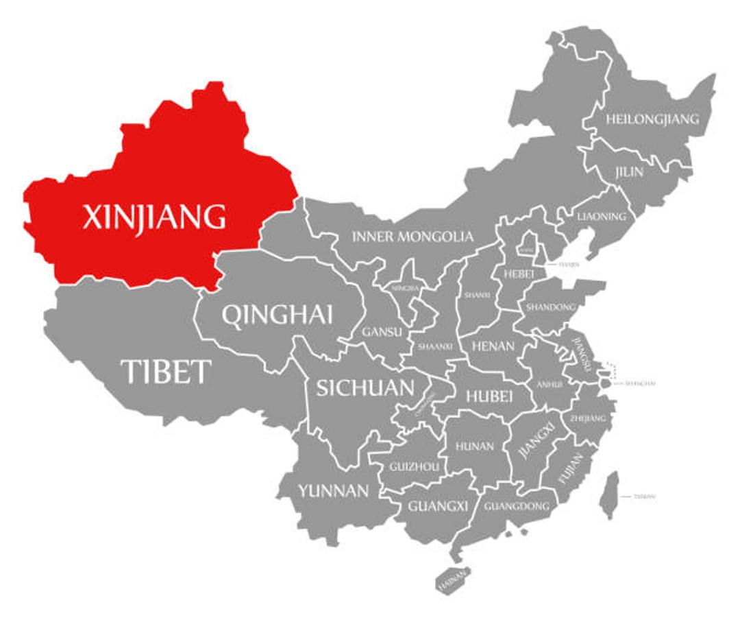
There’s a sharp contrast between east and west in China. The surprisingly diverse and empty provinces of Xinjian and Tibet are a kaleidoscope of cultures and travel experiences.
Life here is on a different clock. And it’s not only the landscape that changes!
Finally, the soul of China resides in the central part of the country. Locations such as Wuhan and Changsha overflow with history and tradition.
Picture strolling on streets with a story to tell from years gone by, yet are vibrant with the present. This is the heart of China in its purest form.
Key Cities and Their Map Location
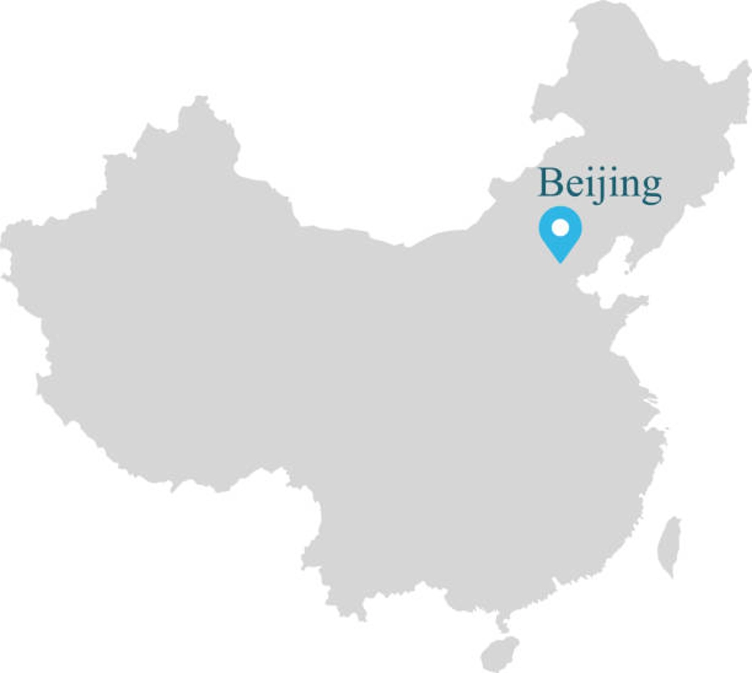
Proudly looking out over the Bohai Sea in the northeast of China is Beijing. This is no ordinary city, though.
This is China’s capital and political epicenter. It’s where buildings are old, history runs deep, stories are whispered, and the past carries on to future generations.
Here you’ll see places like the Forbidden City and iconic Tiananmen Square, and uncover the country’s rich and vibrant history and culture.
Head south to Shanghai, a megacity on the coast teeming with new.
It sits on a bay off the East China Sea, and is a stunning example of the space-age metropolis that’s rising across mainland China, yet it also has a lot of history.
The skyline view from the Bund is breathtaking and will remind any traveler that, in Shanghai, you’re in the future.
Xi’an, located in central China, is one of the oldest cities in the country. It’s like stepping back in time.
There is an interesting fact about China, do you know the Terracotta Army is located there? The army (soldiers are made entirely of clay) is standing guard at the emperor’s tomb, so a visit to Xian is an absolute must-do while traveling around the country.
Continue southwest to Chengdu, home of the favorite Chinese dish, hotpot, and the cutest animals in the country, panda bears. Surrounded by the Kuan and Zhai Alleys, it’s a giant playground for the taste buds and the eyes.
Seeing the pandas is an amazing experience. Do not skip Chengdu! It’s delicious, super cute, and offers some tasty food and wildlife!
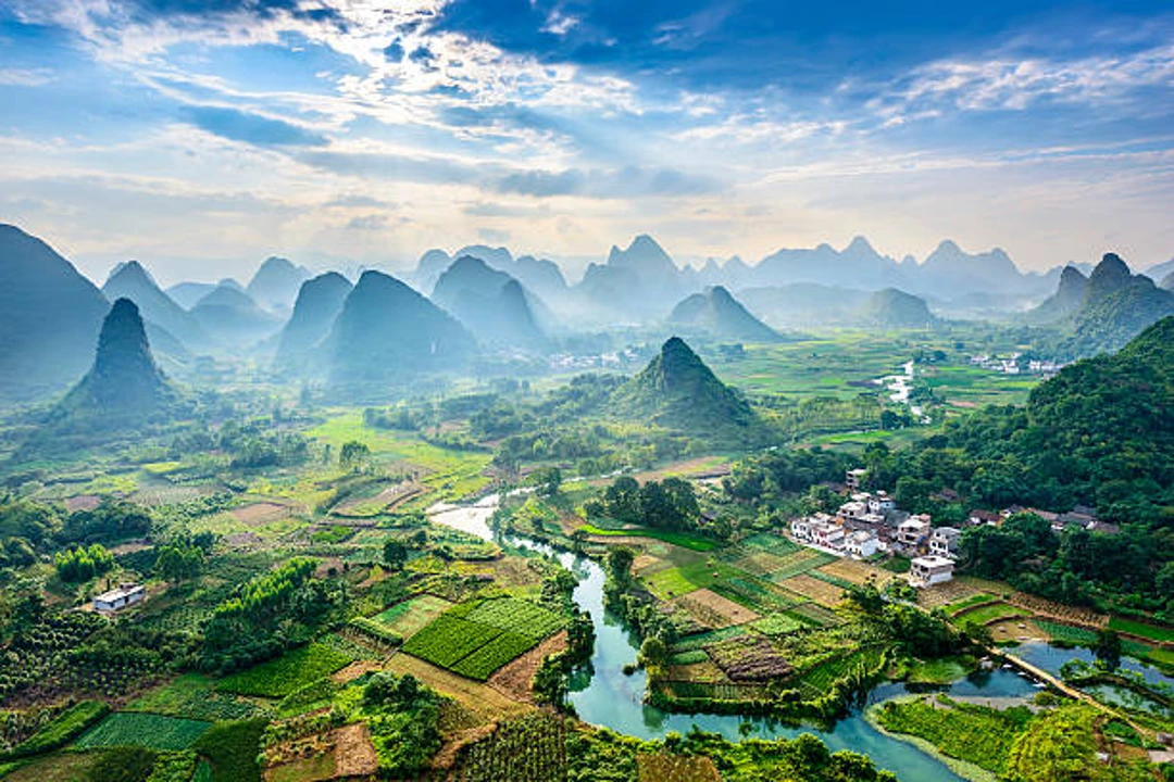
Located in the south of China this magnificent area and its incredibly karst mountains are not to be missed. The dramatic peaks have inspired poets, artists, photographers, and travelers for centuries.
Li River. Take a boat ride on the Li River and feel like you’ve stepped into a painting. Because that’s what it looks like. I’m not sure what else to say about Guilin. It’s just stunning. If you’re in the area, go there. You won’t regret it.
Over on the western side is Lhasa, the ever-popular gateway to the Tibetan Plateau. This mountain city is a center of spiritual activity, home to monasteries that instill a sense of peace and awe.
It feels almost otherworldly when you’re walking through the Potala Palace; it’s mysterious and serene. This is the first step to a whole new world.
How to Use the Map to Plan Your Trip
Going to China seems overwhelming, but with a map it’s a lot of fun. Just list the areas you’d like to visit. For the classic Beijing–Xi’an–Shanghai route, follow the “Golden Triangle”.
It’s a popular route that really does provide a good cross-section of history, tradition, and modernity in each of the cities.
If you like nature, go down south. Guilin, Yangshuo, and Zhangjiajie have stunning landscapes. Picture walking among karst mountains or the Avatar scenery.
This area is quite surreal, and you can easily lose yourself and be one with nature here.
Getting across the country is not too hard, either. Take the high-speed rail and regional flights; they whisk you from one side to the other in no time, allowing you to see more without spending all your time on the road.
And don’t forget to download some offline map apps. They’re indispensable when you find yourself will little or no internet connectivity.
Simply knowing you have access to a reliable map at all times can be very comforting and efficient during your travels.

Travel Tips for Exploring China by Region
Best Times to Visit Different Areas
China is a huge country, and temperatures can differ wildly depending on where you are. In the north, for example in Beijing, autumn weather is cool and golden and thus it is the best time to visit the Great Wall.
If you’re in the south (Guilin or Guangzhou, for example), spring is the most comfortable, with lots of flowers and not too much heat.
If you are on the eastern coast (Shanghai), late spring and early autumn are the best times to visit, avoiding the hot summers and typhoon season.
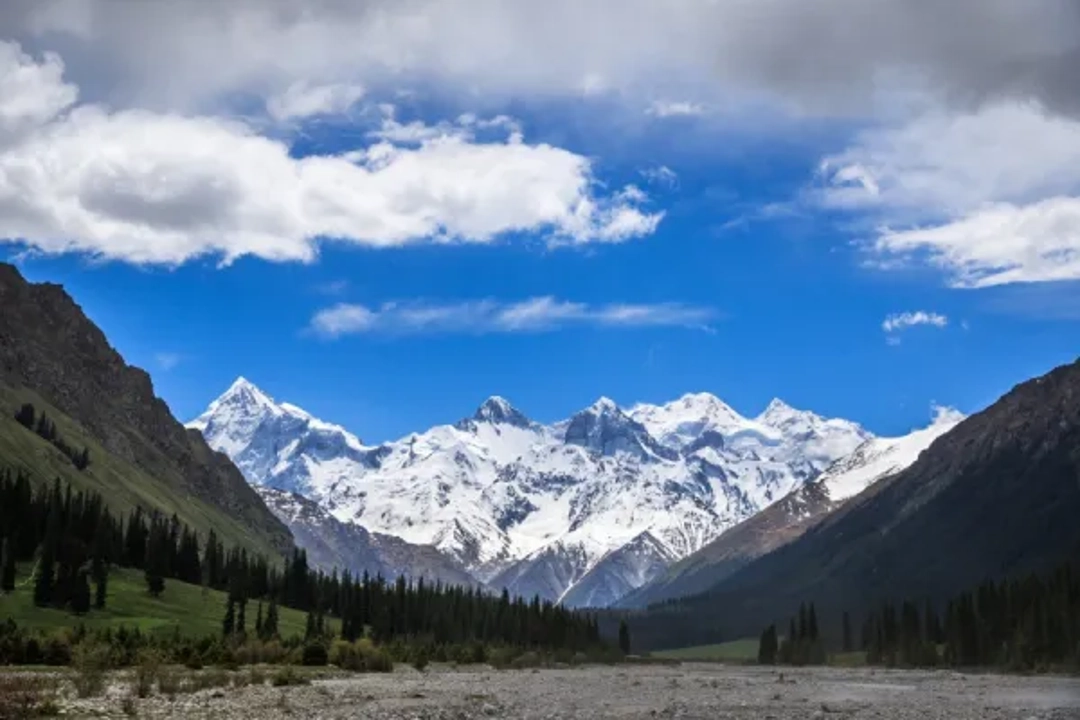
The western part of China is home to some of the country’s most dramatic landscapes, and the weather here is best in late spring or early autumn.
Regional Cuisines to Try
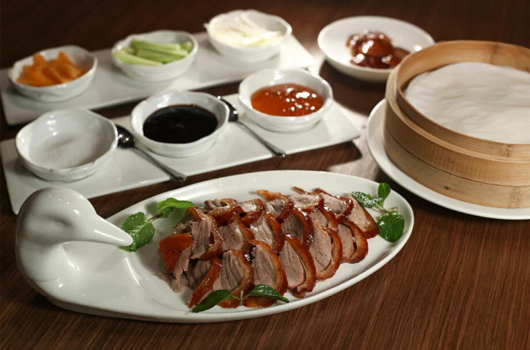
You have to try the Peking duck in Beijing, super crispy and tasty. In Sichuan, prepare for a hotpot that’s like a spicy explosion in your mouth (in a good way!).
Dim sum in Guangdong is fantastic — and who could pass up on this lovely, delicious native cuisine? I love all the noodles in the north – each region does them differently! How can you not eat them all?
Language Tips: Mandarin Basics, Dialects by Region
Mandarin is the most commonly spoken language in China, and it’s incredibly useful, but China has dozens of dialects and languages. In the south, Cantonese is prevalent, particularly in Guangzhou.
Although you don’t need to be fluent, learning some basic Mandarin can help. Try with “Ni hao”(Hello) and “Xie xie”(Thank you).
Additionally, if you travel to places like Tibet or Inner Mongolia, you might hear entirely different dialects, adding a little pizzazz to your visit in the form of new sounds and stories.
FAQ
1. How about trains — is it easy to take the train in China?
Yes, China boasts one of the largest and fastest high-speed trains in the world.
2. Where can you find the Yangtze River on the China map?
It runs from the Tibetan Plateau in the west to Shanghai in the east, bisecting central China.
3. Is a map in China the same as an international map?
Slightly — China uses GCJ-02 GPS coordinates, so there can be minor discrepancies.
Conclusion
From the snow-capped mountains of the west to the bustling coastal cities of the east, China’s expansive map offers plenty of bucket-list destinations.
By understanding a bit about its geography, not only can you plan road trips more easily, but you’ll also develop a greater appreciation for this nation of both natural and cultural diversity.
Go get a map, circle your dream spots, and let China amaze you, region by region.